News & Alerts

FLOOD WATCH for Lake Nipissing Shoreline (Callander and North Bay)
The North Bay-Mattawa Conservation Authority has issued a Flood Watch for the Lake Nipissing shoreline, including the Municipality of Callander and the City of North Bay.
A Flood Watch indicates that the potential for flooding exists within specific watercourses and municipalities.
Municipalities, emergency services, and residents in flood-prone areas are advised to monitor conditions and be prepared.
Risk
Water levels have been rising rapidly in response to recent rainfall and snowmelt and are expected to continue increasing. Flooding in low-lying areas may begin as early as next week.
All residents, particularly those in low-lying or shoreline areas, are encouraged to closely monitor conditions. Riverbanks and shorelines are currently unstable and slippery.
Combined with fast-moving, cold water, these conditions present a significant safety risk. Residents are strongly advised to keep children and pets away from all watercourses and waterbodies.
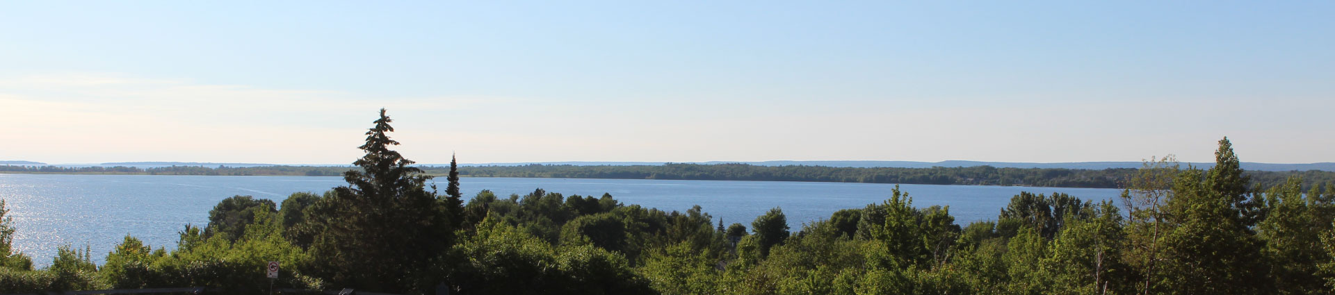
Current Conditions
Approximately 80 mm of rainfall fell across the watershed between April 12 and 14. Total precipitation for April has exceeded 200% of the monthly average, as recorded at the North Bay Airport.
As a result of sustained rainfall and recent snowmelt, water levels and flows across the watershed have increased significantly. Area lakes remain largely ice-covered.
Lake Nipissing water levels have risen quickly and have already reached typical summer navigation levels, with continued increases expected. Runoff into the lake remains high.
Forecasted Conditions
Environment and Climate Change Canada has issued a rainfall advisory for April 18, forecasting 20–30 mm of rain, which may be heavy at times, with a risk of thunderstorms.
Strong southerly winds are also expected as the weather system moves through.
Temperatures are forecast to remain above freezing in the short term before dropping closer to freezing early next week. Limited precipitation is expected later in the week.
Water levels and flows in local rivers and creeks are expected to rise further as rainfall and remaining snowmelt move through the watershed.
Lake Nipissing water levels are currently increasing at a rate of approximately 10 cm per day and are expected to continue rising.
Public Services and Procurement Canada forecasts that water levels may exceed non-damage thresholds by early next week.
Current projections suggest that water levels in the coming weeks may be comparable to those experienced during the 2019 flooding event, and it is possible that levels could exceed those previously recorded.
Future water levels will depend on incoming river flows, additional precipitation, and outflows through the control structures on the French River.
Next Steps
Residents in flood-prone areas are encouraged to:
Sand and sandbags are available to residents and can be picked up at Nipissing Street near the gate to the Operations Yard.
The Municipality of Callander will continue to monitor conditions closely and provide updates as necessary.
April 17, 2026 – 4:30 PM EDT
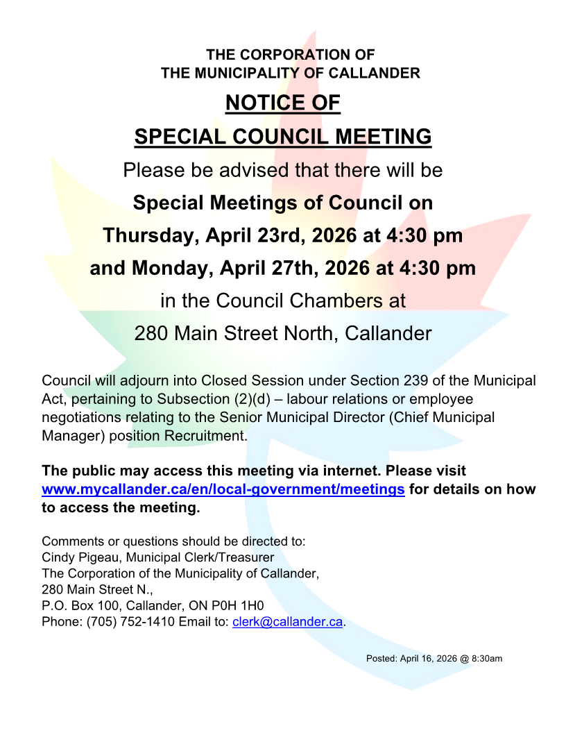
Special Meetings of Council on Thursday, April 23rd, 2026, and Monday, April 27th, 2026
FLOOD WARNING for North Bay - Mattawa watershed
.png)
We need you!